
Extract GPS Coordinates from Digital Photos
How to use the Exif Tool to extract GPS coordinates from a digital photograph. Location services will usually have to have been enabled for photos on the device. Exchangeable image file format (EXIF) can be important in any investigation. The EXIF file format stores additional meta data (data about the data) for image formats like JPEGs.
- Download Exif Tool
- Open the ZIP file.
- To run, click and drag a photo, or photos, onto the Exif tool application.
- Within a few seconds the Exif data will appear to include the GPS longitude and latitude.
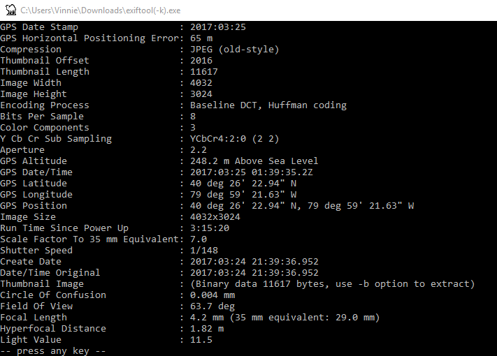
Exiftool - Copy and past the GPS Position into Google Maps.

GPS - Ensure you substitute ” deg” with ° (using ALT + 248)
ALT + 248 = °
40 deg 26′ 22.94″ N, 79 deg 59′ 21.63″ W
40° 26′ 22.94″ N, 79° 59′ 21.63″ W

Extract GPS Coordinates from Digital Photos